

The Praya reclamation began in 1889. The same year's sheet of the city, the Plan of the City of Victoria, still shows the shore as it was before the first spade went in, with the whole north coast divided into numbered districts and the racecourse drawn at Wongnei Chong Valley.
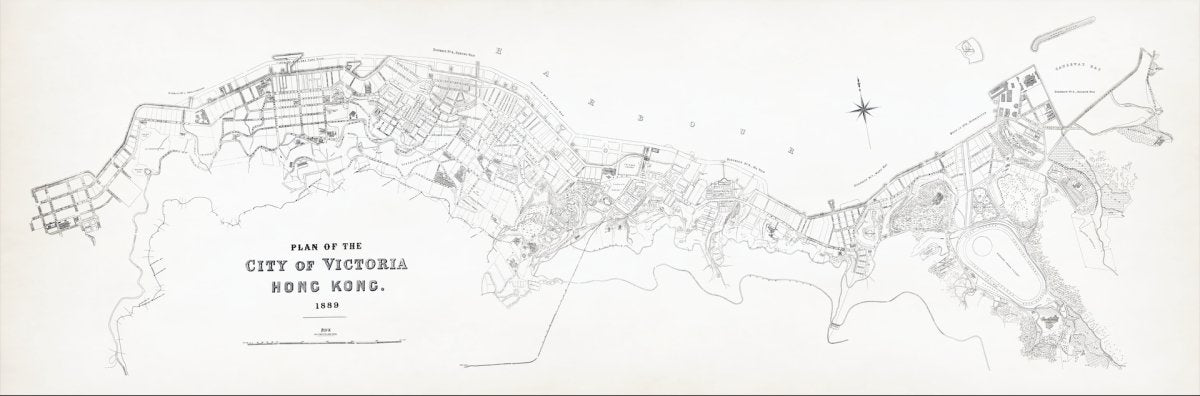
The title, and where the year is printed
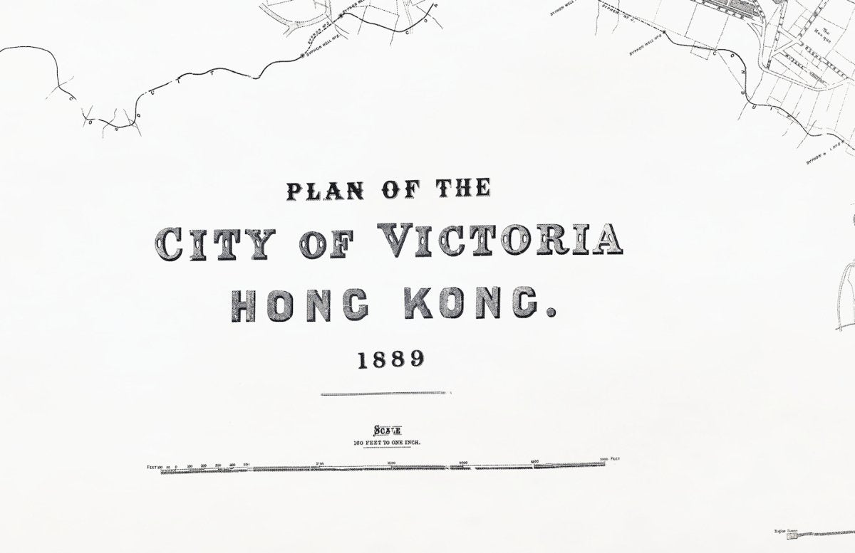
On this sheet the year is part of the title itself: Plan of the City of Victoria, Hong Kong. 1889. Beneath it sits the scale line. That is worth remembering when you look at any old sheet: the title block holds the date, and everything else about how the map was drawn sits close to it.
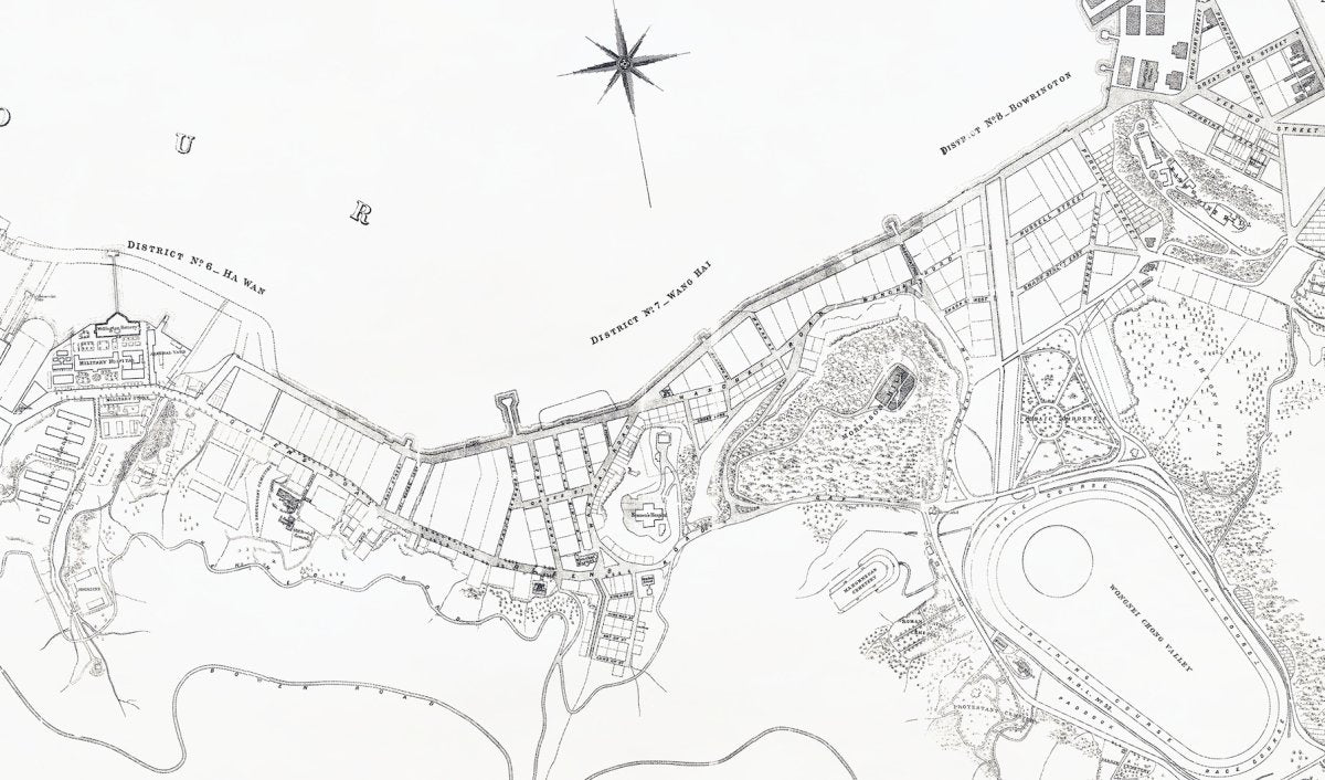
Numbered districts along the shore
Along the harbour the sheet divides the coast into districts, each number printed on the shoreline itself. Reading west to east, the names are District No. 6 - Ha Wan, No. 7 - Wang Hai, No. 8 - Bowrington, and No. 9 - Sockun Poo, with Causeway Bay also lettered across the water. The Chinese glosses attached to those names in the captions are modern equivalents, not text printed on the sheet.
If you are handling more than one sheet, the district numbers are the quickest way to line up a stretch of coast across the years without guessing where a street used to be.
The year the Praya reclamation began
Chater's Praya scheme was the largest of the nineteenth-century reclamations: from the gasworks at Sai Ying Pun east to Murray Pier, 10,200 feet long and 250 feet wide, adding 58.7 acres to the city. Work started in 1889 and finished in 1903, and the new waterfront road is today's Connaught Road. Our 1889 sheet therefore belongs to the last generation of the old shoreline, the one drawn the year the works began.
The city was changing in other ways as well. HK Electric, whose own history records the start of supply in 1890, was about to light the streets of the same city this sheet describes, still drawn in the year when gas lamps were the norm.
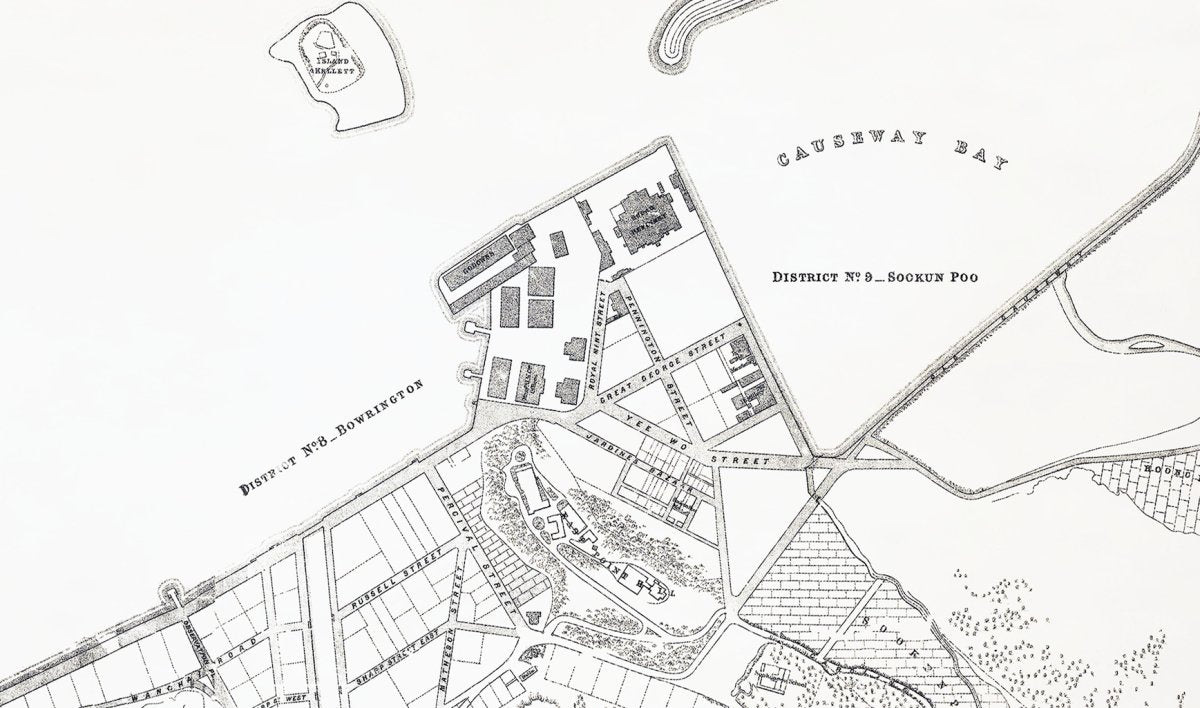
Street names, the racecourse and the cemeteries
The Causeway Bay end of the sheet is the most densely drawn. The street names are printed street by street: Great George Street, Percival Street, Russell Street and Paterson Street, with Jardine's Bazaar among them, and the Praya running along the seaward edge of the new blocks.
Inland, the map labels the racecourse itself - the oval track, with the Training Ground and Paddock marked inside it - under the name Wongnei Chong Valley, the ground known today as Happy Valley. To the west of the valley, the cemeteries are marked one by one: the Parsee, Protestant and Mohammedan cemeteries. A compass rose sits in the upper part of the sheet for orientation.

Checking the date for yourself
Three things do most of the work. First, the title block: the year is printed under the title. Second, the Central waterfront: if no part of Connaught Road appears, the sheet is likely to predate 1889; if a broad reclaimed strip is drawn with the road already along it, the sheet belongs to the 1890s or later, since the reclamation was built in stages. Third, the Lands Department holds aerial photographs from 1924 onwards, and the public can search and view them free through Hong Kong Map Service 2.0, which is the quickest way to follow one district across the twentieth century.

Related maps
Our canvas prints come in two sizes for these long sheets, with an optional wooden frame, and shipping to Hong Kong and overseas. If you want the coastline before and after the reclamation began, these pair well:
- 1889 Victoria City map on canvas
- 1888 Hong Kong Island map on canvas, the year before the works began
- 1890 map of Hong Kong, Kowloon and the New Territories
- 1909 map of the whole of Hong Kong, after the reclamation was finished
Sources
This article draws on the following public sources, together with our own reading of the 1889 sheet (title, districts, street names and the racecourse). Copyright in the sources remains with their authors and institutions. The map images shown are digitally restored versions of the sheet in our own collection, not raw scans.
- Hong Kong Memory, "Central Reclamation" (in Chinese), hkmemory.org (accessed 8 October 2026)
- HK Electric, About Us, hkelectric.com (accessed 8 October 2026)
- Lands Department, aerial photographs from 1924, landsd.gov.hk (accessed 8 October 2026)
- Government Records Service, online holdings, grs.gov.hk (accessed 8 October 2026)