

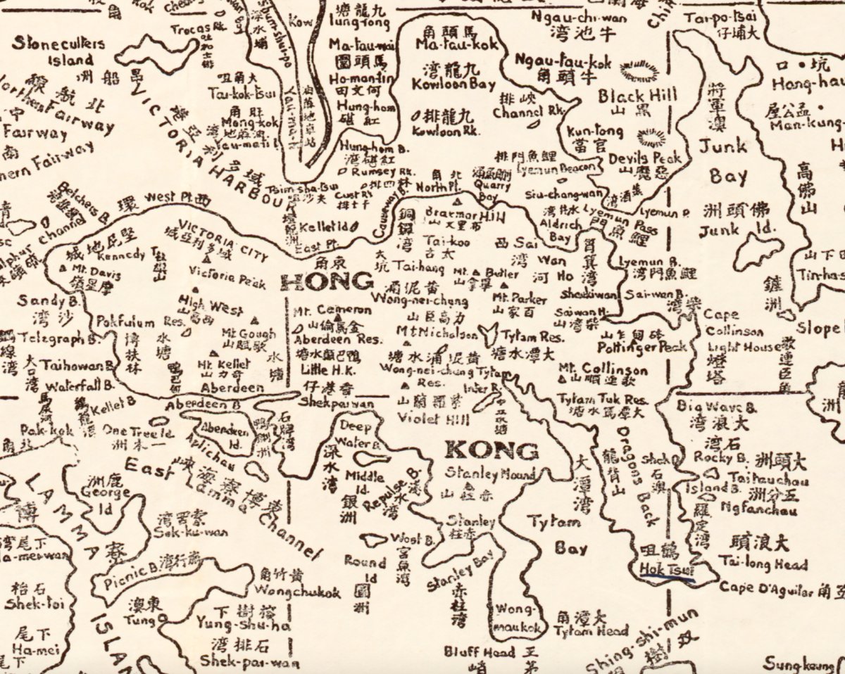
On the 1935 map of Hong Kong, Kwun Tong is nothing more than a name: Kun-tong 官塘. Around it are printed Ngau Tau Kok (Ngau-fau-kok), Kowloon Bay, Devil's Peak, Lyeemun Pass, Junk Bay and Clear Water Bay.
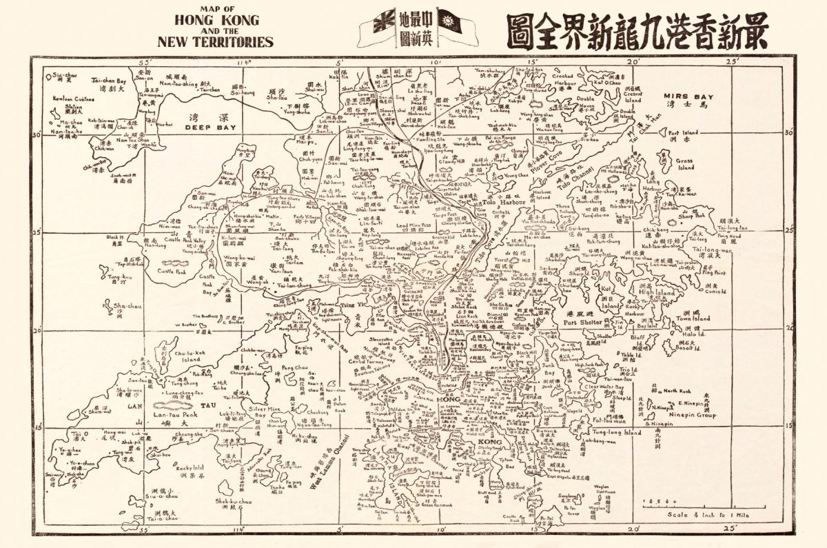
What is actually printed on the sheet
- Kun-tong 官塘 — a place name beside the bay east of Kowloon Bay.
- Ngau-fau-kok 牛頭角 and Kowloon Bay 九龍灣 — today both are dense industrial and residential districts; on this sheet the coastline still leads.
- Devil's Peak 魔鬼山 and Lyeemun Pass 鯉魚門 — still the hill and channel guarding the entrance to Victoria Harbour.
- A string of small bays: Siu-chang-wan, Sai-wan and Lyeemun B.
One honest note: this is a whole-territory map at a small scale, so street names are as printed on the physical sheet — street-level detail does not exist at this scale.

What happened in the next twenty years
- 1954 — press reports describe reclamation between Kwun Tong and Cha Kwo Ling for an industrial estate, with manufacturers asking the government for cheap land (Wikipedia, Kwun Tong, citing The Kung Sheung Daily News, 2 September 1954).
- 1957 — the government completed reclamation off Kwun Tong and offered the land to factories; the southern strip became an industrial area.
- Kwun Tong became Hong Kong's first satellite town; its factory-district streets mostly carry the character 業 ("industry") in auspicious pairings.
- After 1949 large numbers of Chiu Chow and Hoklo-speaking migrants settled there, alongside the original Hakka villages.

Why this sheet is worth hanging
Because it records the coast before it became a factory district. Twenty years later this was the largest industrial area in east Kowloon; decades after that, towers. That contrast needs no caption.
Our edition is a high-resolution digital restoration, not the original sheet: the printed size differs from the original, and the scale bar on the map refers to the original, not to the print.
Choosing a size
This is a landscape whole-territory sheet with dense detail — bigger reads better. The product page has an interactive size guide: type your wall or furniture width and see the framed print (the preview is for reference only).
See the 1935 map of Hong Kong →
To see Kowloon Bay marked "Proposed Reclamation" before the airport, see the 1924 Kowloon map.
Shipping and returns
Ships from Hong Kong in 3–14 days. Damaged in transit? We replace it.